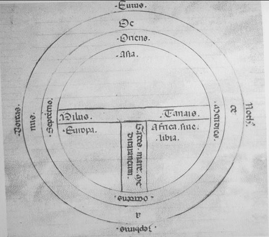
This is a T O Map. This map gets its name from its appearance--it looks like a T inside an O--and evolved during the Middle Ages. The circle was a representation of the known universe while the T divided the world into the three known continents (Europe, Asia, and Africa). The top of the map points east (in contrast to maps today that are usually oriented to the north). The portion above the horizontal line of the T represents Asia, while Europe is on the left and Africa is on the right of the vertical line of the T. The T represents the waterways (Black and Aegean Sea, Nile and Red Sea, and Mediterranean Sea) while the circle represented the oceans surrounding the continent.