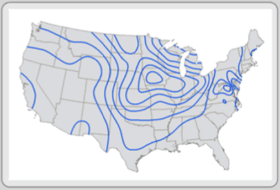
This is an Isoline Map. Isolines are used to describe distributions on a map. Isolines are commonly used in weather maps but can be used for any type of data. Lines connect in places that have the same data. The data used in isoline maps is interval or ratio (sometimes ordinal) and the feature type is raster or vector.